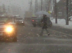
WINTER WEATHER ADVISORY WINTRY PRECIPITATION FORECAST AFTER MIDNIGHT THROUGH EARLY MONDAY AFTERNOON...
…WINTER WEATHER ADVISORY REMAINS IN EFFECT FROM 3 AM TO 4 PM
EST MONDAY…
* LOCATIONS…INTERIOR PORTIONS OF NORTHEAST NEW JERSEY…THE
LOWER HUDSON VALLEY…AND SOUTHERN CONNECTICUT.
* HAZARD TYPES…A MIX OF SNOW…SLEET…AND FREEZING RAIN.
* ACCUMULATIONS…ICE ACCUMULATIONS FROM ONE TENTH TO ONE QUARTER
OF AN INCH WITH SNOW ACCUMULATIONS OF UP TO 1 INCH.
* WINDS…SOUTHWEST 5 TO 10 MPH.
* TEMPERATURES…IN THE LOWER TO MID 20S TONIGHT RISING INTO THE
MID 30S MONDAY AFTERNOON.
* TIMING…WINTRY MIX DEVELOPS AFTER MIDNIGHT AND WILL CONTINUE
THROUGH MONDAY AFTERNOON.
* IMPACTS…HAZARDOUS TRAVEL DUE TO ICY ROADWAYS AND WALK WAYS.
PRECAUTIONARY/PREPAREDNESS ACTIONS…
A WINTER WEATHER ADVISORY MEANS THAT PERIODS OF SNOW…SLEET…OR
FREEZING RAIN WILL CA– USE TRAVEL DIFFICULTIES. BE PREPARED FOR
SLIPPERY ROADS AND LIMITED VISIBILITIES…AND — USE CAUTION WHILE
DRIVING.

![]()


Since the kids have to show their reasoning in math, the Superintendent should now have to show his reasoning in school closings. There was nothing coming down at 5:30am when the school decided to call a late opening. In fact, the storm will hit around 10 as the kids make their way to school. What was the logic for a late opening?
If you were going to close based on a prediction, you could have closed at 10pm last night. By 5:30am the only thing that had changed was that the storm had clearly not started yet.
Continue to look out the window not much but rain,maybe we should close the schools so the children do not melt.