Posted on

NJ TRANSIT Restores Majority of Bus and Access Link Routes in New Jersey

Ridgewood bus terminal theridgewoodblog.net

NJ TRANSIT Restores Majority of Bus and Access Link Routes in New Jersey

Customers advised to prepare for delays and detours on many routes.

After the devastating destruction left behind by Hurricane Sandy, NJ TRANSIT will resumed the majority of Bus and Access Link service starting Thursday, November 1.

Thursday’s restoration of service comes on the heels of the Governor Christie’s  earlier announcement that River Line light rail service resumed operations Wednesday afternoon, making trips every 30 minutes between the Walter Rand Transportation Center in Camden and Trenton Transit Center.

Bus Service:

Starting today, November 1, NJ TRANSIT will restore bus service on 68 bus routes in northern and central New Jersey and 18 bus routes in southern New Jersey, providing service over the entire routes with no detours or truncations.

Also today, NJ TRANSIT will restore partial service on 58 bus routes in northern and central New Jersey and 17 routes in southern New Jersey that will operate with detours or truncations due to ongoing impacts from Hurricane Sandy.

Northern and Central

The following routes will all operate over the entire route, with no detours and no truncations:

Nos. 1, 5, 6, 11, 21, 26, 27, 28, 29, 37, 39, 41, 48, 52, 62, 63, 64, 70, 71, 78, 80, 81, 82, 84, 86, 94, 99, 107,108, 111, 113, 122, 124, 125, 127, 129, 136, 144, 145, 148, 151, 154, 155, 156, 157, 159, 160, 161, 162, 164, 175, 181, 182, 186, 190, 191, 192, 193, 198, 250,258,320, 321,324, 704, 712, 871, 872, 873, 875 and 880.

The following bus routes will resume service with detours or truncations due to ongoing impacts from Hurricane Sandy:

·        No. 13 – Minor detour on 13N and 13C at Kingsland Rd at Washington St

·        No. 25 – Maplewood to Newark Penn Station

·        No. 30 – Minor detour in N. Arlington; Ridge Roadd, Sealy Street and Passaic Street

·        No. 34 – Service to Penn Station only

·        No. 40 – Minor detour in North Arlington on Ridge Road, Sealy Street, and Passaic Street

·        No. 56 – Minor detour on Wood Avenue in Linden

·        No. 58 – Minor detour on Michigan Avenue in Cranford

·        No. 59 – Minor detour on Jersey Avenue in Elizabeth

·        No. 65 – Minor detour on Mountain Avenue in Scotch Plains

·        No. 66 – Minor detour on Mountain Avenue in Scotch Plains

·        No. 67 – There will be no 67 Express trips.  All local trips will start at Lakewood instead of Toms River.  There will no service from Toms River to Lakewood.

·        No. 68 – No service on Route 516.  All service will start at Routes 18 and 9.

·        No. 72 – Detour in Clifton

·        No. 73 – Minor detour in Florham Park due to closure of Peach Tree Rd

·        No. 74 – Detour in Passaic

·        No. 76 – Minor detour in Belleville along Belleville Turnpike and Kearney Ave

·        No. 83 – Major detour at Westside Industrial

·        No. 85 – Access to Hoboken uncertain and service may end at Congress, Jersey City

·        No. 87 – Short trips from Gates Avenue to Journal Square – no service to Hoboken

·        No. 89 – Access to Hoboken questionable. Service can end at 19th St

·        No. 90 – Minor detour on Washington Street in Bloomfield

·        No. 112 – Minor detour on Jersey Ave in Elizabeth

·        No. 115 – Regular service only, Elizabeth Ave service not operational

·        No. 117 – Service will run parallel to Route 22 to compensate for Bus No. 114 ridership

·        No. 121 – Trips terminate at 69th Street

·        No. 123 – Major detour at Palisades Ave. Trip may end at Congress Street, Jersey City

·        No. 126 – Willow/Clinton Service & Hamilton Park Eliminated – Customers can board at Washington Street and 14th Street in Hoboken for service into New York.

·        No. 128 – Trips operating outside Park

·        No. 130 – No service to Covered Bridge, morning peak service will start from Union Hill.

·        No. 132 – No service to Jackson

·        No. 133 – Service will start at Route 516 and Route9. No service on Ticetown Road and Crotell Road.

·        No. 135 – Regular service from Main and Route 34. Detour on Route 34 to Lloyd Road.

·        No. 137 – Express tripswill run as scheduled. 137 Local trips will start at Lakewood.

·        No. 138 – Trips will start at Route 18 and Route 9. There will be no service to Spotswood.

·        No. 139 – Regular service from Lakewood to New York on Route 9. There will be no service to Englishtown, Covered Bridge or Stone Harbor.

·        No. 153 – No service to Linwood Park Loop – Service starts outside the park

·        No. 158 – Major detour of north of Route 5 – Service traveling along Palisade Avenue

·        No. 163 – Major detour in Upper Ridgewood

·        No. 165 – Service starts at New Bridge Rail Station

·        No. 166 – No service to Merrit Gardens- Service starts at Madison & Washington avenues

·        No. 167 – No service north of Chestnut Bend or Harrington Park Service

·        No. 168 – No service north of Bergen Mall.No Paramus Park Service

·        No. 171 – Minor detour in Paterson

·        No. 177 – No service north of Chestnut Bend, no service to Harrington Park

·        No. 178 – Detour on Forest Avenue

·        No. 188 – Major detour of north of Route 5

·        No. 194 – No service toStockholm – Service begins at New Foundland

·        No. 195 – No access to Allwood Park & Ride

·        No. 196 – No service north of West Milford, No Skyline Drive

·        No. 197 – No service north of West Milford, No Skyline Drive

·        No. 199 – Operating with detours through Lyndhurst and Nutley

·        No. 319 – Terminates at Toms River

·        No. 703 – Haledon service discontinued. Service starts at Broadway Terminal

·        No. 770 -Minor detour in Paterson

·        No. 874 – Minor detour; E. Halsey Rd to Parsippany Rd

Southern New Jersey

The following bus routes will resume full service with no detours or truncations:  Nos. 313, 400, 401, 402, 403, 404, 405, 406, 407, 408, 410, 412, 413, 414, 417, 418, 450, 451, 452, 453, 459, 455, 460 and 463.

The following bus routes will resume service with detours or truncations due to ongoing impacts from Hurricane Sandy:

·        No. 315 – No service to Stone Harbor, Avalon and Sea Isle City due to the closure of Stone Harbor Bridge.

·        No.  317 – No service beyond Fort Dix

·        No. 319 – No service to Atlantic City

·        No. 409 – No service from Burlington to Trenton

·        No. 419 – No service on York Drive and Woodland Road in Beverly

·        No. 455 – Minor detour on Kingstown Drive

·        No. 457 – Minor detour on Church Road between Fellowship Road and Route 38 in Cherry Hill

·        No. 502 – No service to/from Atlantic City

·        No. 507 – No service to/from Atlantic City and Ocean City

·        No. 508 – No service to/from Atlantic City

·        No. 509 – Service between Pleasantville to Somers Point only

·        No. 551 – No service from Avandale to Atlantic City

·        No. 552 – No service to/from Atlantic City

·        No. 553 – No service to/from Atlantic City

·        No. 554 – No service to/from Atlantic City

·        No. 559 – No service to/from Atlantic City

Bus service on routes not listed remains suspended until further notice.  Power outages in local communities have resulted in the loss of traffic control devices critical to safe operation in some areas.  Downed tree limbs and power lines continue to make many roads impassable.  Personnel are in the field reviewing and assessing these conditions in order to ensure that service is restored as soonas it becomes safe to do so.

Due to significant damage to theState’s public transportation network, NJ TRANSIT rail service will remain suspended until further notice.  Newark Light Rail and Hudson Bergen Light Rail service alsoremain suspended until further notice.

Rail Service:

·        There is no estimated time for the resumption of service.  Service will remain suspended until further notice.

·        Crews continue to inspect the rail infrastructure to get a full assessment of damage:

·        NJ TRANSIT’s Rail Operations Center—the central nervous system of the railroad—was engulfed in water, which damaged backup power supply systems, the emergency generator, and the computer system that controls the movement of trains and power supply.

·        Local power outages have prevented NJ TRANSIT rail operations from being able to further test crossing gates and operating signals.

·        Hundreds of downed trees have fallen across the rail system, which have caused damage to overhead wires and signal wires.

·        There are rail washouts across the system, including on the North Jersey Coast Line, Atlantic City Rail Line as well as at Kearny Junction, the critical link which enables MidTOWN Direct service to access the Northeast Corridor.

·        Several rail stations have sustained flood damage, including Hoboken Terminal.

·        Morgan Drawbridge on the North Jersey Coast Line in South Amboy sustained damage from boats and a trailer that collided into the bridge.

Light Rail Service:

·        River Line resumed full service starting at 3 p.m. Wednesday, operating on a Sunday schedule, every 30 minutesr Rand Transportation Center in Camden and Trenton Transit Center.

·        Hudson-Bergen Light Rail, Newark Light Rail service will remain suspended until further notice.  There is currently no estimated time for resumption of service.   Hudson-Bergen Light Rail experienced track washouts at Port Imperial and West Side Avenue stations, as well as trees in the overhead wire in Weehawken and flooding in Hoboken.

·        Crews continue to inspect the light rail infrastructure to get a full assessment of damage.

·        Newark Light Rail sustained flooding in Newark Penn Station, as well as major debris damage between Newark Penn and Branch Brook Park stations.

Access Link:

·        Access Link service will resume today, November 1, in the following regions:

·        Region 2, which includes Burlington, Camden, Cumberland, Gloucester and Salem counties.

·        Region 3, which includes Atlantic, Cape May and Southern Ocean County.

Service Updates:

For the latest travel information, customers should listen to broadcast traffic reports, visit or access NJ TRANSIT’s Twitter feed at @NJ_TRANSIT. Additionally, NJ TRANSIT will provide the most current service information via the My Transit alert system (www.njtransit.com/mytransit), which delivers travel advisories for your specific trip to your cell phone, PDA or pager. Service information is also available by calling (973) 275-5555

Posted on

NJ Office of Emergency Management : Driving

linwood theridgewoodblog.net

NJ Office of Emergency Management

A MESSAGE ABOUT DISASTERS AND DRIVING

Regarding travel on the road, please keep these points in mind:

– Don’t go on the roads unless you are essential to the disaster response.

– There is no ban on driving, BUT there are travel restrictions in many counties e.g., Atlantic, Cumberland, Camden. The Parkway is closed from Exit 38 South and there is the possibility of expanding the closure.

– Regardless of current rain conditions, drive slower to avoid losing control when you drive into ponding and standing water that is already on every roadway.

– Never drive through standing water, even if you think your vehicle can clear the depth. Even if you have an SUV. You could stall and block access for emergency workers

– Expect that flash flooding can turn a stream under a roadway into a river, capable of washing vehicles right off the road. This resulted in a tragic death during Irene.

– If you don’t have to be on the road, stay home. This is no time to venture out for sightseeing or taking photographs and videos.

Posted on

PORT AUTHORITY UPDATE ON CONDITIONS AT TRANSPORTATION FACILITIES

IMG00385 20111210 2023

PORT AUTHORITY UPDATE ON CONDITIONS AT TRANSPORTATION FACILITIES
October 29, 2012

As landfall of Hurricane Sandy approaches, the Port Authority of New York and New Jersey reports the following update on conditions at its transportation facilities as of 7 a.m. today:

Airports

The Port Authority’s airports – John F. Kennedy International, Newark Liberty International, Stewart International and LaGuardia airports – are open. However, air carriers have ceased operations until further notice, and we are encouraging travelers not to travel to the airports.

Rail service on AirTrain JFK and AirTrain Newark has been suspended until further notice.

PATH

All PATH service was suspended as of midnight until further notice.

Ports

The Port Authority’s maritime facilities are closed until further notice.

Tunnels and Bridges

The Port Authority’s tunnels and bridges are open. However, Port Authority staff will closely monitor the wind and flooding conditions. Closures will be determined on a case-by-case basis, based on high winds, rainfall and roadway conditions. However, closures are anticipated later today. Motorists are urged reduce speeds when roadways are wet, and pay close attention to posted electronic messages for important information.

Port Authority Bus Terminal

All public and private bus service has been suspended until further notice.

Passengers are reminded to check https://www.panynj.gov/ for updated information about PATH, the airports, the tunnels and bridges, and all other Port Authority facilities. For further information about safety precautions, evacuation routes and best practices for New York State, visit https://www.governor.ny.gov/stormwatch. For New Jersey, visit www.ready.nj.gov.

Posted on

WEATHER ALERT : Hurricane Sandy still remains hundreds of miles away from New Jersey

293830 744377666017 2046801715 n

Photo by Ereny Milad Seaside Heights looks like early Sunday evening… storm didn’t even hit yet

WEATHER ALERT : Hurricane Sandy still remains hundreds of miles away from New Jersey
October 29.2012
the Staff of the Ridgewood blog

Ridgewood NJ, Hurricane Sandy still remains hundreds of miles away from New Jersey but the superstorm has been making its approach known, with high winds, rough surf and coastal flooding. Landfall is expected near Barnegat between 7 and 11pm tonight.

According to News 12 New Jersey Meteorologist James Gregorio , Hurricane Sandy is about 425 miles southeast of New York City and the center of the storm is expected to be near the Jersey Shore late tonight.( https://www.news12.com/articleDetail.jsp?articleId=338541&position=1&news_type=news&region_name=NJ&regionId=2&utm_source=News12NJ&utm_medium=twitter )

Gregorio says the storm has top sustained winds of 75 mph, with higher gusts. Hurricane-force winds extend up to 175 miles from the storm’s center and a potentially lethal storm surge of 4 to 11 feet across much of the region. The punishing winds that could cause widespread power outages. ( https://www.news12.com/articleDetail.jsp?articleId=338541&position=1&news_type=news&region_name=NJ&regionId=2&utm_source=News12NJ&utm_medium=twitter)


Posted on

MESSAGE FROM THE RIDGEWOOD OFFICE OF EMERGENCY MANEMENT:

Ridgewood Village Hall theridgewoodblog.net 5

THIS IS AN URGENT MESSAGE FROM THE RIDGEWOOD OFFICE OF EMERGENCY MANAGEMENT:

HURRICANE SANDY IS EXPECTED TO IMPACT OUR AREA AS EARLY AS SUNDAY NIGHT. WIND GUSTS COULD REACH 75 MPH CAUSING SIGNFICANT RISK TO LIFE AND PROPERTY. MAJOR FLOODING IS ALSO EXPECTED.

RESDIENTS ARE WARNED TO TAKE IMMEDIATE ACTION TO PREPARE.

SECURE OUTDOOR FURNITURE AND OTHER LOOSE OBJECTS.

MOVE TO HIGHER GROUND IF YOU ARE IN A FLOOD-PRONE AREA.

BE PREPARED TO SELF-EVACUATE. ALSO BE PREPARED TO SHELTER IN PLACE, WITH AT LEAST A 3 DAY SUPPLY OF FOOD AND WATER.

IF YOU MUST GO OUTSIDE, AVOID DOWNED TREES AND POWER LINES. AND STAY AWAY FROM FLOOD WATERS.

CALLL 9-1-1 ONLY FOR LIFE THREATENING EMERGENCIES.

Posted on

Christie Administration Begins Preparations For Possible NJ TRANSIT System Shutdown

Ridgewood bus terminal theridgewoodblog.net 1

Christie Administration Begins Preparations For Possible NJ TRANSIT System Shutdown

TRENTON, NJ –The Christie Administration has announced that preparations have officially begun for the potential shutdown of NJ TRANSIT bus, rail, light rail and Access Link service, effective Monday, October 29. This preliminary step is being implemented as the statewide transportation agency continues preparations for Hurricane Sandy.

“The safety of our customers, employees and the public-at-large is paramount,” said NJ TRANSIT Board Chairman and New Jersey Department of Transportation Commissioner James Simpson. “By beginning this important process, NJ TRANSIT will be better able to support the state’s response to Hurricane Sandy by freeing up buses or other resources that may be needed for hurricane relief.”

During Hurricane Irene, NJ TRANSIT implemented a full-scale system shutdown spanning nearly 36 hours. This decision is credited with saving billions in NJ TRANSIT assets, which enabled NJ TRANSIT to restart service with all equipment available for use. Additionally, no customer or employee injuries were reported during this time.

The systematic shutdown of NJ TRANSIT service will require a minimum of 12 hours to complete. The process requires the relocation and securing of buses, rail equipment and other NJ TRANSIT assets away from flood-prone areas. It also requires complete coordination with state and local officials throughout the process.

It is important to specifically note that this step is being taken solely as a precautionary measure. No final decisions have been made regarding any potential future service suspension.

Earlier today, Governor Christie announced system-wide cross-honoring of all rail, bus and light rail tickets starting Monday, 12:00 a.m. and continuing through Wednesday, 6 a.m. This important step will allow customers holding NJ TRANSIT tickets to use alternate means of transportation to get to their final destination, such as PATH, PATCO and private bus carriers. Due to the duration of the storm and the potential impact to the NJ TRANSIT system, this timeframe could be extended if necessary.

NJ TRANSIT PREPARATIONS FOR HURRICANE SANDY

Rail and Light Rail Operations
NJ TRANSIT’s maintenance forces continue inspecting culverts, drainage pipes and rights-of-way to ensure they are clear of blockages that could exacerbate flooding and disrupt service.
NJ TRANSIT rail and light rail crews and equipment are on standby to respond to downed trees, wires and flooding.
Bus and Access Link Operations
NJ TRANSIT Bus and Access Link maintenance and support staff will be on standby 24/7 to respond where needed.
Customer Service
Customer Service Field Offices will extend their hours of operations if necessary.
The Transit Information Office (TIC) – NJ TRANSIT’s call center, is also prepared to extend its hours if necessary.

TRAVEL ADVICE
For the latest travel information, customers should listen to broadcast traffic reports, visit njtransit.com or access our Twitter feed at @NJ_TRANSIT prior to starting your trip.
In the event of service delays or adjustments, including the suspension of service, NJ TRANSIT will provide the most current service information via the My Transit alert system, which delivers travel advisories for your specific trip to your cell phone, PDA or pager. (If you are not yet a My Transit subscriber, we encourage you to sign up at www.njtransit.com/mytransit) Service information is also available by calling (973) 275-5555.
Listen closely to public address announcements at stations for late-breaking service information.
Build additional travel time into your trip to a station, terminal or bus stop.
Stairs, floors and platforms can be slippery, so please use caution when walking along wet surfaces or any outdoor surface exposed to the weather. Use extra care when boarding or exiting buses and trains.
Report slippery or unsafe conditions to bus operators, train crews or to NJ TRANSIT staff.

Posted on

NATIONAL WEATHER SERVICE : FLOOD WATCH

VillageHall floods theridgewoodblog.net 2

File Photo By Boyd Loving

NATIONAL WEATHER SERVICE : FLOOD WATCH
554 AM EDT SUN OCT 28 2012

…SIGNIFICANT FLOODING POSSIBLE MONDAY INTO TUESDAY…

…FLOOD WATCH REMAINS IN EFFECT FROM MONDAY MORNING THROUGH
TUESDAY AFTERNOON…

THE FLOOD WATCH CONTINUES FOR

* PORTIONS OF SOUTHERN CONNECTICUT…NORTHEAST NEW JERSEY AND
SOUTHEAST NEW YORK…INCLUDING THE FOLLOWING AREAS…IN
SOUTHERN CONNECTICUT…NORTHERN FAIRFIELD…NORTHERN
MIDDLESEX…NORTHERN NEW HAVEN…NORTHERN NEW LONDON…
SOUTHERN FAIRFIELD…SOUTHERN MIDDLESEX…SOUTHERN NEW HAVEN
AND SOUTHERN NEW LONDON. IN NORTHEAST NEW JERSEY…EASTERN
BERGEN…EASTERN ESSEX…EASTERN PASSAIC…EASTERN UNION…
HUDSON…WESTERN BERGEN…WESTERN ESSEX…WESTERN PASSAIC AND
WESTERN UNION. IN SOUTHEAST NEW YORK…BRONX…KINGS
(BROOKLYN)…NEW YORK (MANHATTAN)…NORTHEASTERN SUFFOLK…
NORTHERN NASSAU…NORTHERN QUEENS…NORTHERN WESTCHESTER…
NORTHWESTERN SUFFOLK…ORANGE…PUTNAM…RICHMOND (STATEN
ISLAND)…ROCKLAND…SOUTHEASTERN SUFFOLK…SOUTHERN NASSAU…
SOUTHERN QUEENS…SOUTHERN WESTCHESTER AND SOUTHWESTERN
SUFFOLK.

* FROM MONDAY MORNING THROUGH TUESDAY AFTERNOON

* A DANGEROUS COASTAL STORM IS EXPECTED TO BRING BETWEEN 2 AND 6
INCHES OF RAIN EARLY MONDAY MORNING THROUGH TUESDAY. THE HIGHEST
RAINFALL AMOUNTS ARE EXPECTED IN THE HIGHER ELEVATIONS…IN
AREAS THAT EXPERIENCE PROLONGED HEAVY RAIN BANDS AS WELL AS
AREAS THAT ARE NEAR THE CENTER OF CIRCULATION OF THE STORM.

file Photo Boyd Loving

RAINFALL RATES OF 1 TO 2 INCHES PER HOUR ARE POSSIBLE IN THE
HEAVIEST BANDS.

* THESE RAINFALL AMOUNTS WILL CA– USE WIDESPREAD URBAN AND POOR
DRAINAGE FLOODING MONDAY MORNING INTO TUESDAY…WITH FLOODING
OF FLASHY…FAST RESPONDING STREAMS LIKELY AS WELL. THE URBAN
AND POOR DRAINAGE FLOODING WILL LIKELY BE EXACERBATED BY
FALLEN LEAVES CLOGGING DRAINS…AND ALONG COASTAL AREAS DURING
THE TIMES OF HIGH TIDE.

PRECAUTIONARY/PREPAREDNESS ACTIONS…

A FLOOD WATCH MEANS THERE IS A POTENTIAL FOR FLOODING BASED ON
CURRENT FORECASTS. YOU SHOULD MONITOR LATER FORECASTS AND BE
ALERT FOR POSSIBLE FLOOD WARNINGS. THOSE LIVING IN AREAS PRONE TO
FLOODING SHOULD BE PREPARED TO TAKE ACTION SHOULD FLOODING
DEVELOP.

Posted on

NJ TRANSIT CONTINUES PREPARATIONS FOR HURRICANE SANDY

Ridgewood Train station train is coming theridgewoodblog.net 1

NJ TRANSIT CONTINUES PREPARATIONS FOR HURRICANE SANDY

As Hurricane Sandy moves into the region, NJ TRANSIT is closely monitoring Hurricane Sandy’s movements along the Atlantic Coast and preparing the system to minimize service suspensions and delays as much as possible. Current reports estimate Hurricane Sandy beginning to affect New Jersey late Sunday evening with the storm intensifying Monday into Tuesday.

NJ TRANSIT crews are currently preparing rail, bus and light rail infrastructure for the storm and additional crew and equipment will be on standby to respond to downed trees, wires and flooding when the storm hits. Additionally, NJ TRANSIT is coordinating with state, county and local OEMs (Offices of Emergency Management) to keep them updated on service status, outages and restoration efforts.

Storm forecasts indicate Hurricane Sandy has the potential to impact transit services. It may be necessary for NJ TRANSIT to modify service as conditions change. While every effort will be made to continue operating rail, bus, light rail and Access Link services throughout the state, customers may experience delays, detours or cancellations on their routes due to significant rainfall expected in some areas.

Customers are advised to plan accordingly and anticipate disruptions to service. NJ TRANSIT advises customers:

For the latest travel information, visit njtransit.com or access our Twitter feed at @NJ_TRANSIT prior to starting your trip. In the event of delays or service adjustments, NJ TRANSIT will provide the most current service information via the My Transit alert system, which delivers travel advisories for your specific trip to your cell phone, PDA or pager. (If you are not yet a My Transit subscriber, we encourage you to sign up at www.njtransit.com/mytransit) Service information is also available by calling (973) 275-5555 or from broadcast traffic reports.
Listen closely to public address announcements at stations for late-breaking service information.
Build additional travel time into your trip to a station, terminal or bus stop.
Stairs, flooring and platforms can be slippery, so please use caution when walking along wet surfaces or any outdoor surface exposed to the weather. Use extra care when boarding or exiting buses and trains.
Report slippery or unsafe conditions to bus operators, train crews or NJ TRANSIT staff.

NJ TRANSIT Customer Service Field Offices will extend their hours of operation if necessary. The Transit Information Offices, NJ TRANSIT’s call center, is also prepared to extend its hours if necessary. Customers in need of service information can call (973) 275-5555.

Posted on

Red Cross Urges New Jersey to Plan for Hurricane Sandy

red cross

Red Cross Urges New Jersey to Plan for Hurricane Sandy

The American Red Cross North Jersey Region is monitoring Hurricane Sandy as it heads north along Florida’s coastline and is working closely with government and other New Jersey partners on response plans should the storm have an impact on the state. While it is still too early to predict the precise track Sandy will take, forecasters say the storm may pose a threat to New Jersey early next week.“Now is the time to put your plans in place and shop for any supplies necessary to update your disaster kits,” says Dennis McNulty, director of Disaster Services with the American Red Cross North Jersey Region. “Discuss your communication plan with family members to make sure all household members know what to do should this storm have a major impact on New Jersey.”Just as the Red Cross is preparing for Hurricane Sandy, people in New Jersey should take the threat of Sandy seriously and take steps now to be prepared – build a kit, make a plan and be informed. Preparation is the best protection against the dangers of hurricanes, which may bring flooding, storm surge, high winds and tornadoes.Red Cross tools make it easier for people to make or update plans.

The Hurricane App for iPhone or Android smart phones helps people create a plan, share it with household members and over social networks. In addition, a template and instructions to build a plan are available at redcross.org.

The American Red Cross recommends the following preparedness actions:Get or assemble an emergency preparedness kit:A portable kit, stored in a sturdy, easy to carry, water resistant container should have enough supplies for three days. Check your kit and replace perishable stock every six months. Whether you purchase a kit or choose to build your own, your three-day kit should include:

Water – one gallon per person, per day.
Food – non-perishable, easy-to-prepare items such as tuna fish, peanut butter, crackers, and canned fruit. Make sure to include a manual can opener.
A battery-powered or hand-crank radio, flashlight and plenty of extra batteries.
A first aid kit.
Prescription and non-prescription medication items. Include medical supplies like extra hearing aid batteries, syringes, etc.
Copies of important documents, including birth certificates, insurance policies and social security cards.
Sanitation and personal hygiene items.
Extra cash. ATMs and credit cards won’t work if the power is out.
Special items for infant, elderly or disabled family members.
One blanket or sleeping bag per person.
Pet supplies (collar, leash, ID, food, carrier, bowls).
Prepare a family evacuation plan:
The American Red Cross urges each and every household to develop a household disaster plan.
Meet with your family to create a plan. Discuss the information you have gathered and why it is important to prepare for a disaster.
Identify two meeting places; One right outside your home in case of a sudden emergency, like a fire, and one outside your neighborhood in case you can’t return home.
Be sure to make advanced preparations for your pets. Be aware that pets may not be allowed in shelters. Contact hotels, motels, family members and animal shelters to see if they would allow pets in a disaster situation. Keep a contact list of “pet friendly” locations. If you are asked to evacuate, take your pets with you.
Choose an out-of-area emergency contact person. During or after a disaster, it’s often easier to call long distance, especially if local phone lines are overloaded or out of service. Family members should call this person and tell them where they are. Everyone must know your emergency contact person’s phone number and email address.
Show and explain to each family member how and when to turn off the water and electricity at the main switches. Turn gas off only if instructed by local authorities. Remember, if the gas is shut-off, only a professional can turn it back on.
Plan your evacuation route. Use local maps and identify alternate evacuation routes from home, work and/or school. Know where you are going and how you plan to get there before you leave home.

Be informed:

Find out what types of disaster are likely to occur in your area and how to prepare for each.
Find out how local authorities will contact you during a disaster. Listen to local media broadcasts or NOAA Weather Radio for the latest storm conditions and follow the advice of local authorities.
If you are told to evacuate, do so immediately. You may choose to evacuate sooner than alerted if you think you may need additional time.
Know what to do if a hurricane WATCH is issued:
Listen to weather updates from your battery-powered or hand-cranked radio.
Bring in outdoor objects such as lawn furniture, hanging plants, bicycles, toys and garden tools, anchor objects that cannot be brought inside.
Close all windows and doors. Cover windows with storm shutters or plywood.
If time permits, and you live in an identified surge zone, elevate furniture or move it to a higher floor to protect it from flooding.
Fill your vehicle’s gas tank.
Check your disaster supplies kit to make sure items have not expired.
Know what to do if a hurricane WARNING is issued:
Listen to the advice of local officials, and leave if they tell you to do so.
If in a manufactured home, check tie-downs and evacuate as told by local authorities.
Secure your home by unplugging appliances and turning off electricity and the main water valve.
If you are not advised to evacuate, stay inside, away from windows, skylights and glass doors.
Do NOT use open flames, such as candles and kerosene lamps, as a source of light.
If power is lost, turn off appliances to reduce damage from a power surge when electricity is restored.

For more information about hurricane preparedness, visit www.redcross.org.

Posted on

Storm Notice – No leaves are to be placed in the street on Saturday, Sunday or Monday

fallleaves artchick.biz 3

Storm Notice – No leaves are to be placed in the street on Saturday, Sunday or Monday

This is a notice from the Village of Ridgewood Public Works Department concerning Hurricane Sandy which is headed up the East Coast and is expected to affect our area.

If you employ the services of a landscaper, effective immediately, please advise them that unless they remove leaves from your property no leaves are to be placed in the street on Saturday, Sunday or Monday. We encourage homeowners to also follow this same request. With heavy rain expected we must keep roadways and storm drains clear. The Village is requesting your assistance to help avoid unnecessary flooding to your property and your neighbors’.

Village crews will be working today to clear low lying areas. If you have a storm drain in front of your property, please assist Village staff with keeping it clear.

Updated information will be posted on the Village website www.ridgewoodnj.net and we encourage you to sign up for “E-Notice” for updates.

Posted on

PSE&G Ramps Up Preparations for Hurricane Sandy

PSEG truck theridgewoodblog.net

PSE&G Ramps Up Preparations for Hurricane Sandy
October 26, 2012
Provides safety tips for customers

(October 26, 2012 – Newark, NJ) – Public Service Electric and Gas (PSE&G) Company, New Jersey’s largest electric and gas utility, is continuing to closely monitoring the track of Hurricane Sandy and is ramping up emergency preparations. Although the storm is now tracking further south, it is still expected to bring heavy rain, strong winds and flooding to our service territory. At this time, Hurricane Sandy is expected to begin impacting New Jersey as early as late Sunday with the full brunt of the storm hitting the area Monday into Tuesday.

In anticipation of Hurricane Sandy, PSE&G has requested more than 1,300 linemen and 600 tree contractors from utilities in other states to assist our highly skilled crews. The utility’s call center will be fully staffed to handle calls from customers. Other employees will assist with assessing storm damage, keeping the public away from any downed power lines and other functions that support restoration efforts.

Since Hurricane Irene and the October snowstorm in 2011, PSE&G has made additional investments in our electric delivery system to help withstand storms.

• Replaced older 26,000-volt lines with lines capable of carrying 69,000 volts. These lines provide greater protection against lightning strikes and can better withstand wind and rain.
• Spent about $28 million pruning trees away from power lines.
• Tightened coordination with county Offices of Emergency Management to ensure that public officials have the latest information on outages and restoration progress.
• Compiled a list of school administrators and superintendents to contact in case schools are affected by outages.
• Made some improvements to our automated call answering systems.
Just as the utility is preparing for Hurricane Sandy, we urge our customers to do the same. It’s wise to have an emergency kit on hand year round. Here are some things to include:
• A battery powered radio.
• A corded telephone (cordless phones will not work if the power is out)
• Flashlights and extra fresh batteries.
• A first-aid kit.
• Bottled water and an adequate supply of non-perishable food.
• A non-electric can opener.
• Extra blankets and sleeping bags.
• A list of emergency phone numbers, including PSE&G’s Customer Service line: 1-800-436-PSEG.

A storm like Hurricane Sandy has the potential to interrupt service. High winds might cause trees to brush up against power lines, and lightning could strike and damage trees or pole-top equipment. There also is the potential for trees to be uprooted.
Depending on the severity of the storm, response times for both electric and gas emergency services may be longer than usual. PSE&G asks for our customers’ patience and cooperation as we work to safely restore service as quickly as possible. As the storm gets closer, the utility will provide information about estimated restoration times.

To report downed wires or power outages, customers should call PSE&G’s Customer Service line at 1-800-436-PSEG. PSE&G uses an automated system to handle customer calls as efficiently as possible. Customers who get an automated response when calling PSE&G are encouraged to use it, as it is designed to route their calls to the right destination quickly. The system also provides the option to speak directly to a customer service representative. If you have specific information regarding damage to wires, transformers or poles, we ask that you speak with a representative to provide that information.

Customers with a handheld device, or who are at an alternate location with power, can also report power outages and view the status of their outage by logging in to My Account at pseg.com. General outage activity throughout our service territory is available online at www.pseg.com/outagecenter and updates are posted on pseg.com during severe weather.

In addition, PSE&G will activate its Twitter page to keep the public informed about our restoration progress. Sign up as a follower at https://twitter.com/psegdelivers to monitor restoration progress.

Posted on

HAZARDOUS WEATHER OUTLOOK: DANGEROUS COASTAL STORM

weather alert

HAZARDOUS WEATHER OUTLOOK
NATIONAL WEATHER SERVICE NEW YORK NY
400 PM EDT THU OCT 25 2012

SOUTH SHORE BAYS FROM JONES INLET THROUGH SHINNECOCK BAY-
NORTHERN FAIRFIELD-NORTHERN NEW HAVEN-NORTHERN MIDDLESEX-
NORTHERN NEW LONDON-SOUTHERN FAIRFIELD-SOUTHERN NEW HAVEN-
SOUTHERN MIDDLESEX-SOUTHERN NEW LONDON-WESTERN PASSAIC-
EASTERN PASSAIC-HUDSON-WESTERN BERGEN-EASTERN BERGEN-WESTERN ESSEX-
EASTERN ESSEX-WESTERN UNION-EASTERN UNION-ORANGE-PUTNAM-ROCKLAND-
NORTHERN WESTCHESTER-SOUTHERN WESTCHESTER-NEW YORK (MANHATTAN)-BRONX-
RICHMOND (STATEN ISLAND)-KINGS (BROOKLYN)-NORTHWESTERN SUFFOLK-
NORTHEASTERN SUFFOLK-SOUTHWESTERN SUFFOLK-SOUTHEASTERN SUFFOLK-
NORTHERN QUEENS-NORTHERN NASSAU-SOUTHERN QUEENS-SOUTHERN NASSAU-
400 PM EDT THU OCT 25 2012

THIS HAZARDOUS WEATHER OUTLOOK IS FOR ATLANTIC COASTAL
WATERS…SOUTHERN CONNECTICUT…NORTHEAST NEW JERSEY AND SOUTHEAST
NEW YORK.

.DAY ONE…THIS AFTERNOON AND TONIGHT.

HAZARDOUS WEATHER NOT EXPECTED AT THIS TIME.

.DAYS TWO THROUGH SEVEN…FRIDAY THROUGH WEDNESDAY.

THERE IS INCREASING CONFIDENCE THAT THE TRI-STATE AREA WILL FEEL
THE IMPACTS OF A DANGEROUS COASTAL STORM LATE THIS WEEKEND INTO
EARLY NEXT WEEK. THIS INCLUDES THE POTENTIAL FOR HEAVY RAINFALL
AND RESULTANT SIGNIFICANT URBAN…SMALL STREAM…AND RIVER
FLOODING…HIGH WINDS CAUSING WIDESPREAD DOWNING OF TREES AND
POWER LINES…AND SIGNIFICANT SHORELINE IMPACTS FROM COASTAL
FLOODING AND BEACH EROSION. THE SPECIFIC IMPACTS WILL ULTIMATELY
DEPEND ON THE EXACT TRACK AND EVOLUTION OF TROPICAL CYCLONE SANDY
AS IT INTERACTS WITH A DEEPENING UPPER LEVEL LOW PRESSURE SYSTEM
APPROACHING THE EAST COAST.

PLEASE REFER TO THE NATIONAL HURRICANE CENTER FOR THE LATEST
FORECASTS ON SANDY…AND MONITOR THE LATEST NATIONAL WEATHER
SERVICE FORECASTS THROUGHOUT THE WEEK.


Posted on

Ribbon cutting at renovated Ridgewood Community Center at the Village Hall

VillageHall floods theridgewoodblog.net

file photo by Boyd Loving

Ribbon cutting at renovated Ridgewood Community Center at the Village Hall 

WEDNESDAY OCTOBER 3, 2012, 10:54 AM
BY DARIUS AMOS
STAFF WRITER
THE RIDGEWOOD NEWS

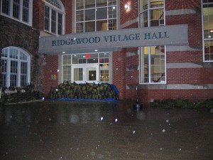
Unlike relentless flood waters that engulfed the first floor at Village Hall one year ago, the rain subsided just in time for last Friday’s grand reopening of the Ridgewood Community Center.

A subdued ribbon-cutting ceremony and the first program inside the renovated Annie Zusy Youth Center marked the official unveiling of the municipal building’s new main level.

Flooding during Hurricane Irene caused hundreds of thousands of dollars in damage to the entire first floor and temporarily displaced several village organizations that had regularly used the space.

“This area is the heart of the community in terms of activities. It was pretty devastating for the communities, especially for children and seniors, when the flooding destroyed this,” said Mayor Paul Aronsohn. “It’s nice that we can welcome them, and everyone, back here.”

An extensive, months-long rehabilitation project had been ongoing throughout the summer. The work included the installation of two types of waterproof concrete blocks inside the hallways and meeting rooms. Blocks were stacked more than 5 feet off the ground, exceeding the height of the former wallboards that were damaged during the flood.

The Village Council bonded $400,000 to cover the construction costs. This sum did not include the initial clean-up bill, which hovered around the $90,000 mark. Federal assistance from FEMA was expected to help fund the project.

https://www.northjersey.com/recreation/172471831_Ribbon_cut_at_renovated_Village_Hall_in_Ridgewood.html

Posted on

Proving the wisdom of building things in flood zones N.J. Senators announce funding for flood-prone area buyout

village hall flood3 theridgewoodblog.net

file photo of Village Hall flooding

Proving the wisdom of building things in flood zones N.J. Senators announce funding for flood-prone area buyout

U.S. Senators Frank R. Lautenberg and Robert Menendez, both D-NJ, announced Wednesday more than $3.3 million in federal funding for voluntary home buyouts for a flood-prone senior citizen housing complex in Monmouth County’s Ocean Township.

The funding, provided through the Federal Emergency Management Agency (FEMA), will be used to purchase and remove eight sections of a seniors apartment complex that has been repeatedly damaged by floods, according to a press release. Built in 1970, the housing complex will be entirely demolished and the area will be restored to its natural environment.  (Bonamo, NJ.com)

https://www.nj.com/monmouth/index.ssf/2012/09/nj_senators_announce_funding_for_flood-prone_area_buyout.html


Posted on

Severe thunderstorms with Freak Tornado Warnings Wreck Havoc in North Jersey

USOPEN Raindelay theridgewoodblog.net

US Open Rain Delay https://f3v3r.com

Severe thunderstorms with Freak Tornado Warnings Wreck Havoc in North Jersey 
September 9 2012
the staff of the Ridgewood blog

Ridgewood NJ ,Rare tornado warnings were issued yesterday after severe weather hit the tri-state area on Saturday knocking down trees ,creating flooding and damaging power lines.

Tornado watches in this part of the country are fairly uncommon, but a tornado warning coupled with a more urgent advisory to seek shelter because of existing tornadic weather conditions is very unusual. There were no actual tornados reported in Northern Jersey, although several were reported elsewhere in the New York tri-state region.

Overcast sky’s , damaging rains and heavy winds were all in play here for much of the day and the fast moving line of storms packed a punch, though fortunately less than originally feared.

Over 10,000 PSE&G customers in New Jersey were left without power, with a concentration in Passaic, Essex and Bergen counties with the Village of Ridgewood among areas that sustained the most damage, with trees and wires down in a dozen locations.

NJ Transit reported that two trains were delayed just after 6 p.m. when a tree branch fell across a track in Glen Rock, with a handful of passengers on both east- and west-bound trains disembarking and boarded trains on an another track while workers spent about 45 minutes clearing away the tree.

The quick-changing weather also affected many outdoor events, forcing a storm delay in a college football game at MetLife Stadium and delaying the men’s semifinals and causing the women’s singles finals to be rescheduled for today at the U.S.