
Tri-State Alert: Severe Flash Flood Watch Extended Across NJ, NY, and CT Through Monday Night
the staff of the Ridgewood blog
A massive weather system is stalling over the Tri-State area, prompting the National Weather Service to extend a critical Flood Watch through late Monday night. With multiple rounds of torrential downpours and severe thunderstorms taking aim at the region, local residents are urged to prepare for rapidly deteriorating conditions and potential flash flooding.
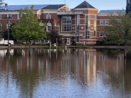
file photo by Boyd Loving
Here is everything you need to know to stay safe, track the storm, and protect your property.
The Forecast: 2 to 4+ Inches of Torrential Rain
Meteorologists warn that the upcoming storm tracks are loaded with excessive moisture. The region is expected to see wide-scale significant rainfall, with dangerous localized bursts.
-
Total Rainfall: General amounts of 2 to 4 inches are anticipated across the board, but localized pockets could see significantly higher totals.
-
Rainfall Rates: Hourly rainfall rates could spike up to 2 inches per hour during peak thunderstorm activity.
-
The Flash Flood Threat: When rain falls that quickly, storm drains and ground surfaces cannot absorb the volume, triggering instant urban flash flooding.

file photo by Boyd Loving
Impacted Areas: Is Your Community at Risk?
The Flood Watch covers a massive footprint across northeast New Jersey, southeast New York, and southern Connecticut.
📍 Northeast New Jersey
-
Bergen County: Eastern & Western Bergen
-
Essex County: Eastern & Western Essex
-
Passaic County: Eastern & Western Passaic
-
Union County: Eastern & Western Union
-
Hudson County
📍 Southeast New York
-
New York City: Bronx, Kings (Brooklyn), New York (Manhattan), Queens (Northern & Southern), Richmond (Staten Island)
-
Long Island: Nassau (Northern & Southern), Suffolk (Northeast, Northwest, Southeast, & Southwest)
-
Hudson Valley & Suburbs: Orange, Putnam, Rockland, and Westchester (Northern & Southern)
📍 Southern Connecticut
-
Fairfield County: Northern & Southern Fairfield
-
Middlesex County: Northern & Southern Middlesex
-
New Haven County: Northern & Southern New Haven
-
New London County: Northern & Southern New London
Key Impacts and Safety Risks
Excessive runoff from these heavy storms will heavily impact low-lying infrastructure. Be prepared for:
-
Rapidly rising water in urban areas, underpasses, and highways.
-
Creeks, streams, and rivers overflowing their banks.
-
Surge flooding in traditionally flood-prone neighborhoods.
Driving Safety Reminder: Flash floods are historically the leading cause of weather-related fatalities in urban storms. If you encounter a flooded roadway while driving, Turn around, don’t drown!
For comprehensive safety protocols and real-time updates, check out the official National Weather Service Flood Safety Guide.
Join the new Saddle River Valley, Ramapo and Pascack Valley Communities Facebook group
https://www.facebook.com/groups/1931704860512551/
#news #follow #media #trending #viral #newsupdate
#currentaffairs #BergenCountyNews #NJBreakingNews #NJHeadlines #NJTopStories
-
Gemini/Search Intent Tags:
#TriStateWeather#FloodWatch#NYWeather#NJWeather#CTWeather#FlashFloodAlert#SevereWeatherUpdate