Posted on

Village of Ridgewood Parks

citizens park theridgewoodblog.net

VILLAGE PARKLANDS
Citizen’s Park
Located at the corner of Godwin Avenue and North Monroe Street. Citizen’s Park includes a softball field, multipurpose field, a small sided softball field, an open play area, benches and gardens.

Dunham Trail
Located between Grove Street and Spring Avenue along the Ho Ho Kus brook and the public service right-of-way. Dunham Trail is one of the Village wildscape areas.

On Dunham trail look for:
Sycamores and a wild cherry tree with shiny gray bark.
Triassic Sandstone, like that used to build Manhattan’s brownstones.
A linden tree wrapped in Poison Ivy rope.
Springtime Dogtooth Violets, False Solomon’s Seal, Spring Beauties, Yellow Primroses, Pink Japanese Knotweed, and the biggest patch of Canadian Mayflowers in Ridgewood.
Graydon Park
Located on the corner of North Maple Avenue and Linwood Avenue. Graydon Park offers a hockey court, skateboard park, basketball courts, swimming, ice-skating, picnic area, shuffleboard, children’s playground, shelter, and restrooms. Click on the following link to find all that Graydon Pool has to offer – Graydon Pool website.

Grove Park
Located on the south side of Grove Street, just west of the Saddle River. This is one of Ridgewood’s wildscape areas, which include nature trails for walking.

In the 32 acres of beech forest and field that make up Grove Park, you will find:
Spring flowers that bloom between April and May before they disappear when the shade thickens.
The tulip poplars are the tallest and straightest trees in the wooded area.
You can look for the honeycombs located on top of the bee tree.
Turkey Tails and fungi can be found on fallen logs.
Kings Pond Park
Located off Lakeview Drive by the Midland Park border. Kings Pond Park offers a natural wildlife area, ice-skating, when permitted, and nature trails for walking. Kings Pond and Gypsy Pond offer a great variety of birds and mammal life.

In the parks you can also find:
Large glacial rocks at Park entrance are Canadian Shield Boulders.
Along the railroad track, wild azalea (pinxter) bloom.
Bracket fern and fiddleheads abound in the woods.
Ducks, Canada Geese and over 40 species of birds live here.
Wild garlic and mustard are abundant.
The general depth of the ponds is about 3 feet.
Leuning Park
Located on the corner of Northern Parkway and Meadowbrook Avenue. Leuning Parks offers an open play area.

Irene Habernickel Family Park
Located at 1037 Hillcrest Road in the northern most corner of the Village, this ten-acre park property has an abundance of mature trees. These trees help to define various areas of the property.

This special park property offers an opportunity for both passive and active recreation through the balance of wide open space, ball fields, natural areas, and a one-acre pond.
In the development stage; plans are to revive the dam and bridge area, install a children’s playground, multi-purpose fields, several walking trails and an arboretum complete with gardens.

This new park is soon to include nature programs as well as other passive opportunities as wildlife prevail such as mammals, reptiles and assorted birds.

Maple Park
Located on the corner of Meadowbrook Avenue and Northern Parkway. Maple Park offers one of Ridgewood wildscape areas as well as a community garden (Link to community garden page), part of the fitness trail (link to the parcourse fitness circuit page), benches, flowers, and nature trails. A regulation turf field hosts soccer, lacross and softball year round.
On the west and east banks of the Ho-Ho-Kus brook between Graydon Pool and Meadowbrook Avenue.

In Maple Park, look for:
A 70-year-old wisteria tree.
One of the largest stands of red cedar in this part of New Jersey.
A Porcupine (Sweet Gum) Tree.
A half dozen of different varieties of fern.
Fig-leaf magnolias with thin graceful leaves.
An herb garden.
On the east side of the brook, delicate grasses, berry bushes, and wild flowers that attract butterflies and birds of many descriptions.
North Road Park
Located on North Road, off of Glen Avenue east of Route 17. This is a natural wildlife area.

Pleasant Park
Located at the end of Stevens Avenue, behind Hawes School. Pleasant Park also offers one of the Village’s wildscape areas.

Pleasant Park offers a natural wildlife area, which includes:
Fallen “nurse” logs, nourishing many insects, lichens, ferns and fungi.
Green beggar ticks, jewelweed, ragweed, and purple loosestrife, all in the late summer.
Quaking aspen trees, with flat leaf stems (petioles) that quiver in the breeze.
New York ferns and lady ferns.
Grape vines.
Sassafras or “mitten” trees, whose name comes from the shape of the leaf.
A tree trunk shaped like a giraffe.
A wide variety of birds reside in this wooded community, which makes for excellent bird watching.
Schedler Property
This recent open space purchase is located between Route 17 and West Saddle River Road with development plans yet to be determined.

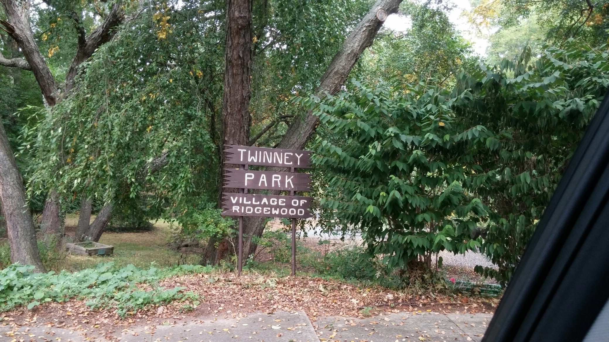
Twinney Pond Park
Located at the north end of Red Birch Court. Twinney pond offers a wildlife area, nature trails and ice-skating.

At Twinney Pond Park, this three foot deep kettle pond created by glaciers, you can see the following:
Sunfish as they sweep clean spots on the pond floor to make nests.
Shaggy Birches, Pin Oaks, and Locust Trees.
Veronica, they look like tiny orchids on the ground.
Button Bushes that will produce white pompoms this summer.
Dragonflies, with clear wings outspread, and Damsel Flies, with wings swept back and colored.
The life cycle of a tadpole.
Ice skating when the weather and ice permits.
Memorial Park at Van Neste Square
Located at East Ridgewood Avenue between Walnut Street and Oak Street. Van Neste offers a relaxing location in the center of town. Located in the park are the War Memorial Monument, benches, and gardens.

Veteran’s Field
Located at the corner of Linwood Avenue and Northern and Parkway. Veteran’s field is home to softball fields, hardball fields, multipurpose fields, running track, fitness circuit, amphitheater, open play area, and restrooms. The walking track is 0.452 miles around.

Posted on

Reader says Dump it at town hall and build a dirt wall to prevent the police station from flooding when it rains

VillageHall_floods_theridgewoodblog

file photo by Boyd Loving

Ridgewood NJ, UPDATE: The Village Council has requested that the Village’s Engineering Department review alternative options with respect to the route(s) dump trucks will take after being loaded with soil excavated at The Dayton construction site. Council members are reluctant to sign off on any plan that directs all trucks through a single residential neighborhood. Alternative options may include distributing the truck traffic via two (2) or more separate routes. A Resolution approving the associated Soil Movement Permit was scheduled for approval at last night’s Village Council Public Meeting, but was removed from the agenda in advance of the meeting.

https://theridgewoodblog.net/the-village-council-has-requested-that-the-villages-engineering-department-review-alternative-options-with-respect-to-the-routes-dump-trucks-will-take-after-being-loaded-with-soil-excavated/

we could use the dirt…
Dump it at town hall and build a dirt wall to prevent the police station from flooding when it rains.
Or take all that dirt and replace the million dollar cancer causing turf over on Maple with some dirt and plant grass.
Or fill in Graydon so those afraid of bird can build a concrete monstrosity

Posted on

Flood Plains In The Village Of Ridgewood

VillageHall_floods_theridgewoodblog

file photo by Boyd Loving

October 17,2017

the staff of the Ridgewood blog

Ridgewood NJ, The Village Of Ridgewood has a number of streams with a flood plain associated with it, Ho-Ho-Kus BrookSaddle RiverGoffle BrookDiamond Brook, and SproutBrook a nondelineated stream behind Gateway Road.

These streams are limited in capacity and tend to exceed there banks during heavy rain falls similiar to Tropical Storm Floyd on September 16, 1999 and Hurricane Irene on August 28, 2011 (both of which can be considered a 100 year flood event).  Additionally, the Nor’easter on April 15, 2007 can be considered a 20 year storm event.

As each storm event varies in duration and inches of rainfall, flow varies through each section of the stream dependant on flow restrictions ie, bridges, culverts, dams and weirs. Preventitive maintenance to keep these areas clear is the Village’s primary goal in keeping flooding to the minimum.

Flood information for the Village is available in the Engineering Division Office. Flood maps from FEMA and the New Jersey Department Of Environmental Protection are available. Documentation from FEMA is available stating the property and/or structure is located in the floodplain.


Flood Insurance

The Village of Ridgewood participates in the Community Rating System (CRS) and has a rating of Class 7, which is administered by the National Flood Insurance Program (NFIP). Because we participate in the CRS program, anyone in the Village of Ridgewood can purchase flood insurance. Please note that standard homeowner’s insurance does not cover damage from floods. Most homeowner’s who have paid off their homes do not continue the flood insurance as required by most mortgage companies. Here are some common Myths and Facts about the National Flood Insurance Program.


Flood Plain Resources

Bergen County Preliminary Flood Map – These are the proposed flood maps for 2017.
Map of Ridgewood Homes in the Flood Plain circa 2006 – link to follow
USGS Saddle River Flood Gauge
USGS HoHoKus Brook Flood Gauge

Community Outreach Resources

Annual Letter to Residents in the Flood Plain 2016
Annual Letter to Realtors 2016
Repetitive Loss Outreach Letter 2016
Flood Plain Management Plan
Flood Plain Management Plan 2015 Annual Report
Elevation Certificates for Homes in the Flood Fringe – link to follow
Open Space Lands within the Flood Plain – link to follow


NEW!!! Hurricane Sandy Mitigation Assessment Team Report 
FEMA P-942, Mitigation Assessment Team Report: Hurricane Sandy in New Jersey and New York
FEMA Building Science & Resources


Flood Plain Regulations

NJDEP – NEW 2016 Flood Hazard Area Control Act Rules N.J.A.C.7:13
NJDEP – Division of Land Use Regulation
E-Code for Village of Ridgewood, NJ
International Residential Code 2015, New Jersey Edition – See section R322 on page 59


Links

FEMA
FEMA Flood Guidance Manuals
Flood Insurance: Top 10 Things Every Homeowner Should Know
FEMA – What to do before, during and after
FEMA Fact Sheet – Cleaning Flooded Buildings
FEMA Map Service Center
Floodsmart.gov – Facts & Statistics
National Weather Service
American Red Cross
Bergen County Office of Emergency Management

Posted on

Village of Ridgewood Moves Forward on Maple Field Replacement

turf_theridgewoodblog

September 8th 2017

the staff of the Ridgewood blog

Ridgewood NJ. the Maple Park turf field is in need of a major update , the Village will apply to Bergen County Open Space funding for the 50/50 matching grant to replace the turf at Maple Field. The Village plans to use Bergen County Open space funds, Village open space funds and money from the capital budget . The decision has been made to replace the 12 year old field due to is heavy use and deteriorated condition.

Resident Boyd Loving asked if the Village expected to receive any money from the class action suite filed against the manufacturing over the fields not living up to their expected life span? Village Attorney Matt Rogers explained that there were on going talks with Field Turf to defray costs of a replacement field and will be made public when negotiations are concluded .

Posted on

Village Council Summer Highlights from August 9th Meeting

Village Council

Village Council Summer Highlights

1. VILLAGE OF RIDGEWOOD MASTER PLAN – Planning Board Master Plan update: funding for the Village Master Plan is in place and the Planning Board advanced the undertaking at the annual reorganization meeting on July 18. A Master Plan Committee was appointed to assist the Planning Board, the Ridgewood Village Council and the public with the Master Plan process including, but not limited to: project education, scheduling, milestones, budgeting, public engagement and participation, and to ensure an open and transparent process. Committee members include Mayor Susan Knudsen, PB Vice-chairman Joel Torielli, Planning Board members Debbie Patire and Melanie McWilliams. **Chairman Richard Joel will be substituting on an interim basis as needed. The Master Plan Committee is a preliminary step prior to formally advancing the Master Plan process. 


2. As one of the most used sports fields the turf at Maple Park is now in need of replacement. Installed more than decade ago, the replacement will allow the field to continue to facilitate a variety of sports programs throughout the year. The Maple Park Turf Replacement is subject to a public hearing scheduled for August 9, 2017.


3. Purchasing the Elks Club Property allows for future planning ensuring a more efficient utility benefiting Ridgewood Water customers. The Water Capital Ordinance for $1,600,000 includes the purchase price of $1.1 mil for the property and $500,000 to renovate the building from the Water Utility Capital Fund. 


4. Summer “School” ordinances: Amending Chapter 265 will prohibit stopping on portions of West Ridgewood Avenue allowing a safer approach to vehicular traffic around the Ridge School. Additionally, Enacting Title 39 on All Public School Properties authorizes the Ridgewood Police Department to enforce traffic and parking regulations on Board of Education property. Ordinance 3612 protects Ridgewood taxpayers from the unlawful enrollment of students in Ridgewood Public Schools through the Village Municipal Court.


5. Direct Village Planner to conduct a study for Redevelopment of the Hudson Street Municipal Parking Lot, allowing the Village more options moving forward with garage construction plans that could potentially save significant taxpayer dollars and build time.

Posted on

Ridgewood Village Council Special Public Meeting and Work Session

Village Council

VILLAGE COUNCIL SPECIAL PUBLIC MEETING

JUNE 28, 2017

7:30 P.M.

1. Call to Order – Mayor

2. Statement of Compliance with the Open Public Meeting Act

MAYOR: “Adequate notice of this meeting has been provided

by a posting on the bulletin board in Village Hall,

by mail to the Ridgewood News, The Record, and by submission to all persons entitled to same as provided by law of a schedule including the date and time of this meeting.”

3. Roll Call

4. RESOLUTIONS

17-170 Award Contract – Infra-red Paving Restoration

17-171 Reject Bids – Central Valet Parking Services

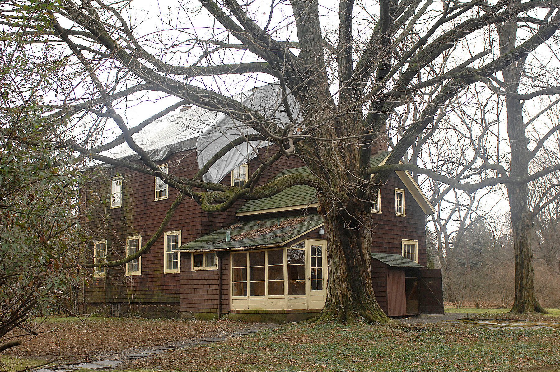
17-172 Authorize Application to the Bergen County Historic Trust Fund – Zabriskie-Schedler House, Phase 2

17-173 Authorize Application to the Bergen County Open Space Trust Fund – Turf Field at Maple Park

17-174 Annual Renewal of Liquor Licenses

17-175 Set Public Hearing Date for Settlement Negotiation

5. Adjournment

VILLAGE COUNCIL WORK SESSION

THE RIDGEWOOD VILLAGE COUNCIL’S

PUBLIC WORKSHOP AGENDA

JUNE 28, 2017

7:30 P.M.

1. 7:30 pm – Call to Order – Mayor

2. Statement of Compliance with Open Public Meeting Act Mayor: “Adequate notice of this meeting has been provided by a posting on the bulletin board in Village Hall, by mail to the Ridgewood News, The Record, and by submission to all persons entitled to same as provided by law of a schedule including the date and time of this meeting.”

3. Roll Call – Village Clerk

4. Flag Salute/Moment of Silence

5. Public Comments (Not to Exceed 3 Minutes per Person – 40 Minutes in Total)

6. Presentation – Open Space Survey Findings

7. Discussion

a. Ridgewood Water

1.  Award of Contract – Infrared Asphalt Restoration

b. Budget

1. Bergen County Open Space Trust Fund Grant Application

c. Operations

1. Purchase of Property

d. Parking

1. Rebid Central Valet Services

8. Motion to Suspend Work Session and Convene Special Public Meeting

9. Special Public Meeting – See At tached Agenda

10. Motion to Adjourn Special Publc Meeting and Reconvene Work Session

11. Discussion (Continued)

a. Ridgewood Water (continued)

1. Lease of Property for Co-Location of Wireless Telecommunications Antennas – Glen Avenue Tank Location

2. Award Contract – Polyphosphate Pumps for Corrosion Control

3. Award Professional Services Contract – Cedar Hill Reservoir Improvements

b. Parking

1. Train Station Parking

2. Update on Parking Garage

3. Clinton Avenue Parking – Safety Concerns

c. Budget

1. Declare Fire Department Equipment Surplus

2. Award Contract Under State Contract – Tires

3. Award Contract Under State Contract – Police Handguns, Holsters, & Magazine Pouches

4. Award Contract Under State Contract – Two Police Patrol SUVs

5. Award Contract Under State Contract – Lifts and Support Stands – Fleet Services

6. Award Contract Under National Joint Powers Alliance – Front End Loaders with Snowplows

7. Award Contract Under National Joint Powers Alliance – Two Sanitation Trucks with Snowplows

b. Policy

1. Boards and Committees – Fields Committee

2. Endorse Bergen County Open Space Trust Fund Program – The James Rose Center

3. Title 59 Approval – Painting Curbs Yellow

4. Options for Glenwood Road Railroad Crossing

5. Amend Chapter 145 – Fees – Tree Protection

6. Garber Square Bike Lane

e. Operations (continued)

1. Appoint Clean Communities Coordinator and Recycling Program Coordinator

2. Municipal Complex Parking Lot Changes

12. Manager’s Report

13. Council Reports

14. Public Comments (Not to Exceed 5 Minutes per Person)

15. Resolution to go into Closed Session

16. Closed Session

A. Legal – COAH; Valley Hospital

B. Personnel –

C. Contract Negotiations –

17. Adjournment

Posted on

Voice of the Taxpayer Must Be Heard in Flood Insurance Debate

RHSFfieldflood_theridgewood-blog
June 15,2017
the staff of the Ridgewood blog

Washington DC, House Financial Services Committee Chairman Jeb Hensarling (R-TX) delivered the following opening statement today about the seven bills the committee is considering related to the National Flood Insurance Program:

There are so many important voices in our debate today on the reauthorization of the National Flood Insurance Program.  Certainly the homeowners who have relied on this program — theirs is a very important voice because we go to their homes and we go to their household finances.  Theirs is a very important voice.  Homebuilders, they have an important voice.  Insurance agents and companies, local communities — these are all important voices in this debate.

But as far as I’m concerned, perhaps the single-most important voice is the voice that remains underrepresented in the debate and that is the voice of the American taxpayer.  The American taxpayer who has been called upon in the past to bail out a program that is currently drowning in $26 billion of red ink and suffers a $1.4 billion annual actuarial deficit.

Maybe that’s why I heard from Kathy in Garland, Texas in my district who wrote:  “It’s just another reason the average person in this country is going under financially.  Far too many programs are being funded by the average American but very few receive any benefits from what they are funding.”

In talking about the program, Steven of Larue in my district said:  “This is just another instance of the federal government wasting the taxpayer dollars over and over and over again on the same problems.  People that choose to live in flood-prone areas after receiving one payment benefit should be removed from the entirety of the program.”

Just two taxpayer comments.  So again, we know for a fact the program is in debt.   We know for a fact the program is running an actual annual deficit.  So it begs the question:  Should there be a permanent taxpayer subsidy? I say no.  It cannot be, not when I’m sitting here looking at a national debt clock that continues to run out of control before us, which I continue to believe is a far under-appreciated clear and present danger to our republic.  Part of those numbers spinning out of control represent  the National Flood Insurance Program.

I don’t know if America will ever become a bankrupt society, but I know the face of bankruptcy is an ugly one.  In Detroit, when it became bankrupt, thousands of street lights couldn’t afford to be replaced and ambulances did not run.  Municipal retiree health care benefits were cut immediately.  In Puerto Rico, hospitals had to lay off workers, ration medication, reduce services.  In Greece, from 2008 to 2013 they became 40 percent poorer.  Homelessness increased 25 percent in four years.

I don’t think America would ever become Puerto Rico, Detroit or Greece, but I don’t know, and it’s not something in good conscience I can ignore.

So I believe we need a National Flood Insurance Program that will make the program fiscally sustainable.  I do believe that people should gradually – gradually – be expected to pay actuarial rates.  They need predictability.  We need to protect them from sticker shock, but the program must be made sustainable.

I believe market competition is important and we have heard evidence that in many places where there has been even limited market competition we have actually seen premiums decreased.  And the industry is poised to come in.  It’s a very different world today than it was half a century ago when this program was launched.  Better risk assessment tools, better financing mechanisms to spread the risk globally. And so this is a bill that, perhaps, it would take as long as 15 years to fully phase in some actuarial rates.  We’re talking today about bills that, if enacted, would increase premiums about $2 a month to put this on the road toward actuarial soundness where all will be protected, no one will be denied a policy, all will benefit from competition and the NFIP will be sustainable and the national debt clock will spin a little less rapidly.

With other important reforms of mapping, mitigation, claims processing protections and reforms, I commend all of the authors of the legislation that we will be marking up today and I look forward to the markup.

Posted on

Bergen County Democrats first Order of Business Raise Taxes

maple+field1-300x19911
January 6th 2016

the staff of the Ridgewood blog

Hackensack NJ, on Wednesday, the three Bergen County freeholders elected in November were sworn into office. Turning Bergen into the bluest of counties and making all county officials in Bergen, Democrats.

The annual reorganization meeting, Freeholders Mary J. Amoroso, Germaine M. Ortiz, and Thomas J. Sullivan were sworn in for their first full three-year terms. Freeholder Tracy Silna Zur–now entering her fifth year as freeholder–was elected as board chairwoman and Sullivan was selected as vice-chair.

The Democrats remained true to form and immediately began by raising what promises to be the first of many tax increases, the open-space tax.

The move increases the open-space tax back to 1 cent per $100 of assessed valuation, which is expected to bring in $12 million more annually for a popular program that had seen its funding cut by 75 percent in recent years.

While many embrace the idea of open space, the devil is as always in the details.Money is often used by the politicly connected for ball fields ie turf and to warehouse space, creating buffer zones for wealthy enclaves and keeping prime real-estate off the market so less desirable projects can not be built.
Posted on

Readers Say we auditoriums in EVERY single school , Why do we need a performing arts center? Not to mention that the property is in a flood zone

ridgewood elks

file photo by Boyd Loving

From the July 2015 Ridgewood Library Board of Trustees Meeting

A couple of library board trustees said they want to move ahead with the original plan, which called only for the renovation of the library, and add in the construction of a performing arts center next to the library and village hall. This would turn the library and its surrounding area into the cultural hub the members are seeking.

The cost of the library renovations alone is estimated at around $5 million, according to Ralph Rosenberg, who was responsible for the renovations 20 years ago. Rosenberg has agreed to advise the trustees throughout the process as “owner’s representative.”

The estimated cost of the renovations, including the hypothetical performing arts center, is unknown.

(Community News | At the Library | Ridgewood Inside NorthJersey.com)

See any common threads here?

Board of Trustees Ridgewood Library

John Johansen, President 12/31/2015
Elisa R. Legg, Vice President
Arlene Sarappo, Secretary 12/31/2018
Gail Campbell, Treasurer
Christine Driscoll 12/31/2018
John Saraceno 12/31/2017
Janis Fuhrman 12/31/2018
Paul Aronsohn, Mayor
Albert Pucciarelli, Mayor’s Delegate
Dr. Daniel Fishbein, Superintendent of Schools
Linda Diorio, Superintendent’s Delegate

Don’t we have auditoriums in EVERY school which can be rented for a very reasonable price. Why do we need a performing arts center? Not to mention that the property is in a flood zone.

Yes, the National Elks organization appears to have been “gotten to”, at least indirectly, by a cabal of local supporters of the idea of building a performing arts center where the Elk’s Lodge now stands. The Local Elk’s club membership is probably reeling at the treatment they have been receiving from their national – level hierarchy. The tax status of the property on which the Elk’s Lodge now sits appears to have also been the subject of hijinks or skullduggery of some sort. Its valuation was dropped by more than half, if memory serves, with no apparent explanation for the change, which sounds like a setup.

Posted on

Ridgewood many tree lined parks to beat the heat

Twinney Pond Park

July 29,2016
the staff  of the Ridgewood blog

Ridgewood NJ, a park is also a nice place to beat the heat and Ridgewood many tree lined parks . Take advantage there are more parks than your realize ; the mission statement of the Ridgewood Department of Parks and Recreation is to preserve open space and provide facilities and year round recreational activities that meet the needs of all residents.

Parks
The Division of Parks is responsible for the maintenance of all Village owned parkland, athletic facilities, planting of flowerbeds (in cooperation with Project Pride) and landscaping throughout the community. In addition, the division is responsible for the preparation and maintenance of the Graydon Pool facility and grounds as well as all departmental special events throughout the year.

Shade Tree
The Shade Tree Division is responsible for the maintenance and care of approximately 15, 000 Village owned street trees on 100 miles of public ways, as well as additional trees and shrubs in parks and on other public grounds. This includes all aspects, such as removal, planting, and pruning. The Shade Tree Division does a tree planting for Arbor Day, which is usually the last Friday in April. The division currently offers a memorial tree/bench program to honor the memory of a friend or family member.

Citizen’s Park
Located at the corner of Godwin Avenue and North Monroe Street. Citizen’s Park includes a softball field, multipurpose field, a small sided softball field, an open play area, benches and gardens.

Dunham Trail
Located between Grove Street and Spring Avenue along the Ho Ho Kus brook and the public service right-of-way. Dunham Trail is one of the Village wildscape areas.

On Dunham trail look for:

Sycamores and a wild cherry tree with shiny gray bark.
Triassic Sandstone, like that used to build Manhattan’s brownstones.
A linden tree wrapped in Poison Ivy rope.
Springtime Dogtooth Violets, False Solomon’s Seal, Spring Beauties, Yellow Primroses, Pink Japanese Knotweed, and the biggest patch of Canadian Mayflowers in Ridgewood.

Graydon Park
Located on the corner of North Maple Avenue and Linwood Avenue. Graydon Park offers a hockey court, skateboard park, basketball courts, swimming, ice-skating, picnic area, shuffleboard, children’s playground, shelter, and restrooms. Click on the following link to find all that Graydon Pool has to offer – Graydon Pool website.

Grove Park
Located on the south side of Grove Street, just west of the Saddle River. This is one of Ridgewood’s wildscape areas, which include nature trails for walking.

In the 32 acres of beech forest and field that make up Grove Park, you will find:

Spring flowers that bloom between April and May before they disappear when the shade thickens.
The tulip poplars are the tallest and straightest trees in the wooded area.
You can look for the honeycombs located on top of the bee tree.
Turkey Tails and fungi can be found on fallen logs.

Kings Pond Park
Located off Lakeview Drive by the Midland Park border. Kings Pond Park offers a natural wildlife area, ice-skating, when permitted, and nature trails for walking. Kings Pond and Gypsy Pond offer a great variety of birds and mammal life.

In the parks you can also find:

Large glacial rocks at Park entrance are Canadian Shield Boulders.
Along the railroad track, wild azalea (pinxter) bloom.
Bracket fern and fiddleheads abound in the woods.
Ducks, Canada Geese and over 40 species of birds live here.
Wild garlic and mustard are abundant.
The general depth of the ponds is about 3 feet.

Leuning Park
Located on the corner of Northern Parkway and Meadowbrook Avenue. Leuning Parks offers an open play area.

Irene Habernickel Family Park
Located at 1037 Hillcrest Road in the northern most corner of the Village, this ten-acre park property has an abundance of mature trees. These trees help to define various areas of the property.

This special park property offers an opportunity for both passive and active recreation through the balance of wide open space, ball fields, natural areas, and a one-acre pond.
In the development stage; plans are to revive the dam and bridge area, install a children’s playground, multi-purpose fields, several walking trails and an arboretum complete with gardens.

This new park is soon to include nature programs as well as other passive opportunities as wildlife prevail such as mammals, reptiles and assorted birds.

Maple Park
Located on the corner of Meadowbrook Avenue and Northern Parkway. Maple Park offers one of Ridgewood wildscape areas as well as a community garden (Link to community garden page), part of the fitness trail (link to the parcourse fitness circuit page), benches, flowers, and nature trails. A regulation turf field hosts soccer, lacross and softball year round.
On the west and east banks of the Ho-Ho-Kus brook between Graydon Pool and Meadowbrook Avenue.

In Maple Park, look for:

A 70-year-old wisteria tree.
One of the largest stands of red cedar in this part of New Jersey.
A Porcupine (Sweet Gum) Tree.
A half dozen of different varieties of fern.
Fig-leaf magnolias with thin graceful leaves.
An herb garden.
On the east side of the brook, delicate grasses, berry bushes, and wild flowers that attract butterflies and birds of many descriptions.

North Road Park
Located on North Road, off of Glen Avenue east of Route 17. This is a natural wildlife area.

Pleasant Park
Located at the end of Stevens Avenue, behind Hawes School. Pleasant Park also offers one of the Village’s wildscape areas.

Pleasant Park offers a natural wildlife area, which includes:

Fallen “nurse” logs, nourishing many insects, lichens, ferns and fungi.
Green beggar ticks, jewelweed, ragweed, and purple loosestrife, all in the late summer.
Quaking aspen trees, with flat leaf stems (petioles) that quiver in the breeze.
New York ferns and lady ferns.
Grape vines.
Sassafras or “mitten” trees, whose name comes from the shape of the leaf.
A tree trunk shaped like a giraffe.
A wide variety of birds reside in this wooded community, which makes for excellent bird watching.

Schedler Property
This recent open space purchase is located between Route 17 and West Saddle River Road with development plans yet to be determined.

Twinney Pond Park
Located at the north end of Red Birch Court. Twinney pond offers a wildlife area, nature trails and ice-skating.

At Twinney Pond Park, this three foot deep kettle pond created by glaciers, you can see the following:

Sunfish as they sweep clean spots on the pond floor to make nests.
Shaggy Birches, Pin Oaks, and Locust Trees.
Veronica, they look like tiny orchids on the ground.
Button Bushes that will produce white pompoms this summer.
Dragonflies, with clear wings outspread, and Damsel Flies, with wings swept back and colored.
The life cycle of a tadpole.
Ice skating when the weather and ice permits.

Memorial Park at Van Neste Square
Located at East Ridgewood Avenue between Walnut Street and Oak Street. Van Neste offers a relaxing location in the center of town. Located in the park are the War Memorial Monument, benches, and gardens.

Veteran’s Field
Located at the corner of Linwood Avenue and Northern and Parkway. Veteran’s field is home to softball fields, hardball fields, multipurpose fields, running track, fitness circuit, amphitheater, open play area, and restrooms.

Posted on

Town-house plan roils Ho-Ho-Kus

Saddle_River_theridgewoodblog

file photo saddle river

JANUARY 17, 2016    LAST UPDATED: SUNDAY, JANUARY 17, 2016, 1:21 AM
BY STEVE JANOSKI
STAFF WRITER |
THE RECORD

HO-HO-KUS — The fate of a developer’s proposal to nestle dozens of town houses in a neighborhood of single-family homes may rely on the state’s new process of getting communities to meet affordable-housing obligations.

The plan, put forward by the Upper Saddle River-based Chamberlain Developers, is to build 45 town homes on a 3.66-acre corner lot off West Saddle River Road and Hollywood Avenue. Some of those units would be designated to help the borough meet its court-mandated obligation to promote housing for low- and moderate-income residents.

But opponents say such dense housing would be wholly out of character in an area dominated by sizable single-family homes.

“For almost 100 years, there’s been single-family development on the applicant’s property,” said Ho-Ho-Kus attorney Robert Inglima, representing four neighboring families opposed to the proposal. “So to take that property and transform it into a site for any number of multifamilyhousing units would be a significant departure from the prior zoning pattern … this is an established neighborhood we’re talking about.”

But land is gold in North Jersey, and as more residents — especially young professionals and empty-nesters — seek smaller units closer to mass transit, development firms are reacting, said Bergen Realtor Robert Abbott.

https://www.northjersey.com/community-news/town-government/town-house-plan-roils-ho-ho-kus-1.1493801

Posted on

Empty Kmart in Paramus to become indoor sports practice facility

indoor training facility

Empty Kmart in Paramus scores a new use

DECEMBER 28, 2015, 6:23 PM    LAST UPDATED: MONDAY, DECEMBER 28, 2015, 6:44 PM
BY JOAN VERDON
STAFF WRITER |
THE RECORD

The vacant, cavernous Kmart store in Paramus has been carpeted with artificial turf and been given a new, if temporary, lease on life as an indoor practice facility for North Jersey sports teams.

On Monday morning, the 91,000-square-foot, hangar-like building, which used to be crowded with store shelves and shoppers, rang with the shouts of two dozen youngsters kicking soccer balls and running drills.

The unusual arrangement meets two separate goals: a Bergen County entrepreneur’s need for a location with enough floor and ceiling space to accommodate several practice fields; and the landlord’s need for a short-term tenant until development plans for the shopping center are finalized.

Scott Vandersnow  of Upper Saddle River this month opened the building as The Arena, an indoor training facility, and has begun renting the space out to youth sports teams. This week, the building is being used for youth soccer and lacrosse camps that Vandersnow is offering for parents who want their kids to stay active during the winter break.

Vandersnow, 41, grew up in Washington Township, has a background in finance and currently works in commercial real estate lending. He is also a soccer dad who has logged many hours watching or running practices for his 10-year-old daughter and 8-year-old son. He said he saw the need for more practice space in Bergen County and was looking for locations when he spotted the Kmart building.

The Kmart, which was built in 1979, closed a year ago after its lease expired. The building is in a strip shopping center owned by the Stop & Shop supermarket chain, and that also houses a Stop & Shop store.

https://www.northjersey.com/news/empty-kmart-in-paramus-scores-a-new-use-1.1481534

Posted on

Quality of Life Issues Abound in Bergen County

maple+field1-300x19911

Battle over Northern Highlands Regional district’s field lights heading to court

NOVEMBER 15, 2015    LAST UPDATED: SUNDAY, NOVEMBER 15, 2015, 9:59 AM
BY MARINA VILLENEUVE
STAFF WRITER |
THE RECORD

ALLENDALE — The Northern Highlands Regional High School Board of Education is going to court to defend the new electric-powered light trailers on its athletic fields.

Three neighboring residents are suing the school district, claiming it’s unlawfully using the mobile trailers with lights up to 72 feet tall in defiance of state and local statutes and past court rulings.

On Thursday, the school board, the Northern Highlands Regional High School Sports Association and the Allendale Planning Board and Board of Adjustment filed a civil action in Superior Court in Hackensack asking a judge to dismiss the neighbors’ lawsuit and declare that the school’s use of the lights is legal.

The school has been using mobile, diesel-powered light trailers ever since the late 1990s, after the Planning Board denied the sports association’s application to build permanent 70-foot-tall light towers with a concrete foundation.

The board is arguing that mobile light trailers don’t require any kind of zoning variance or site-plan approval because they don’t fall under state and local definitions of “structure,” “fixture” or “development.”

The school says that it’s used the new electric-powered light trailers about 30 times since they were delivered in September, and that they’re less noisy and smelly than the previously rented diesel-powered trailers.

“As a result, hundreds of children have been able to safely use the turf field at Northern Highlands after dark,” reads the counterclaim filed Thursday.

The school “shall continue to utilize mobile light trailers in connection with its lawful lighting of the athletic fields on the property,” reads the counterclaim, which seeks compensatory, consequential and punitive damages.

In two counts of the neighbors’ eight-count lawsuit filed in October, they claim the new lights will be a public nuisance harming neighbors and that the Board of Education will be liable for damages.

“The development will give rise to a continual invasion of adjoining property by reason of light trespass and light and noise pollution,” reads the lawsuit, which also claims the taller lights will lead to lowered property values and a worse quality of life.

https://www.northjersey.com/news/crime-and-courts/battle-over-northern-highlands-regional-district-s-field-lights-heading-to-court-1.1455826

Posted on

Old plans could present solution for Schedler

zabriskieschedler_theridgewoodblog

SEPTEMBER 18, 2015    LAST UPDATED: FRIDAY, SEPTEMBER 18, 2015, 12:31 AM
THE RIDGEWOOD NEWS
Print

Old plans could present solution for Schedler

To the Editor:

There can be a sensible alternative to construction of a 90-foot baseball/multiuse field in a heavily wooded area on the Schedler property, and with little cost to the sports groups or the village. There is an existing 80-foot field at Pleasant Park that can be expanded to 90 feet. An existing plan, before the purchase of Schedler, might well be a solution.

In fact, both Veteran’s Field and the Pleasant Field were slated to become 90-foot fields as replacements when the field at Benjamin Franklin Middle School was turned into a track. A 2007-08 report on our Parks and Facilities by Schoor-DePalma-CMX (“Comprehensive Parks, Facilities and Recreation Plan”), paid for by the village, was presented to the council in 2008 recommending that the 80-foot existing baseball field at Pleasant Park be expanded, as well as Veteran’s Field, which now has a 90-foot field.

Of course, this report was written before the Schedler property was purchased.

After Schedler was purchased, the Pleasant Park extension was discarded. Reasons for the change by the village were soil conditions, objections by neighbors, permits from the DEP, etc. But no studies were ever done, and to my knowledge, no correspondence with the state.

The Pleasant Park neighbors are right to be concerned that a 90-foot field brings lights, noise, and traffic that could disrupt the Lawns neighborhood. But why are their concerns more important to the town than the residents on the east side.

Why not revive the idea of adding just a few feet to the existing 80-foot field at Pleasant with the following restrictions: no lights, no turf, and strict penalties for loud and disturbing behavior. As long as the players and fans play by the rules, the neighbors should be glad to help out. We would balance the loss of less than an acre of trees versus over 5 acres of trees at Schedler.

Sure, it would be nice to go across town to an area of east side residents near the Schedler property, put up a field, put in over 70 parking spaces and create problems on a narrow roadway, not to mention cutting down acres of trees that buffer the view and sounds of Route 17.

A traffic study in the middle of August on a residential street is not the right time to see what traffic is really like when school is out, when rush hour occurs, etc.

If this village is concerned about money, how would they justify an outlay of at least $1 million to level 5 acres at least, in an area that is uneven at best, put in a field, create a large berm around most of the property as buffer so trucks or cars don’t crash into the field?

The solution, a much less expensive solution, one that was proposed in the report, paid for by the village, is to extend the field at Pleasant.

Ellie Gruber

Ridgewood


https://www.northjersey.com/opinion/opinion-letters-to-the-editor/letter-to-the-editor-ridgewood-should-revist-old-plans-1.1412615

Posted on

CHRISTIE ADMINISTRATION ANNOUNCES NEW INTERACTIVE FLOOD WARNING MAPS OF HO HO KUS BROOK

RHSFfieldflood_theridgewood-blog

file photo by Boyd Loving

CHRISTIE ADMINISTRATION ANNOUNCES NEW INTERACTIVE FLOOD WARNING MAPS FOR PASSAIC RIVER BASIN 

MAP DETAILS SIX-MILE STRETCH OF RIVER RUNNING THROUGH WALDWICK, HO-HOKUS AND RIDGEWOOD IN BERGEN COUNTY 

Ridgewood NJ, The fourth in a series of online, interactive flood-preparation maps designed to aid emergency management personnel and to inform residents in the Passaic River Basin about flooding events in real time has been launched, Department of Environmental Protection Commissioner Bob Martin announced today. The Ho-Ho-Kus Brook Flood Inundation Map, covering a 6-mile span of the river in Bergen County’s Waldwick Borough, Ho-Ho-Kus Borough and Ridgewood, is the fourth map designated for the Passaic River Basin in response to recommendations made by Governor Christie’s Passaic River Basin Advisory Commission.
The map was developed in a partnership between the DEP and U.S. Geological Survey. Fifteen additional maps covering critical areas of the basin will be produced in coming months as part of a cooperative effort between the DEP, USGS and the U.S. Army Corps of Engineers. Flood inundation mapping is among the recommendations in the commission’s 15-point plan for short-term and long-term measures to help mitigate flooding impacts in the basin. Governor Christie formed the commission in 2011 in response to a series of damaging floods in the basin, which covers significant portions of Bergen, Morris and Passaic counties.
Key recommendations of the plan called for better information to help prepare for and respond to flooding emergencies. “The Christie Administration remains committed to addressing flooding issues in the Passaic River Basin through mitigation, property acquisitions, de-snagging efforts and emergency preparedness and response,” Commissioner Martin said. “These easy-to-use online maps offer real-time information to residents about conditions during significant rainfalls and will assist local, state and federal officials in making critical decision to protect the public in the event of flooding.” “This flood preparedness tool highlights how our agencies and local officials are working together to create more resilient communities, and to provide better flood preparedness and responses to flooding,” added USGS Associate Director for Water Bill Werkheiser.
In addition to this latest map, flood inundation maps are being developed for Lodi, Ridgewood and Upper Saddle River along the Saddle River; for Little Falls, Pine Brook, Chatham, Millington and Clifton along the Passaic River. Maps are also being created for Pompton Lakes, Mahwah and Oakland along the Wanaque River; for two locations in Wanaque along the Wanaque River; for Pompton Plains along the Pompton River; for Riverdale and the Macopin Intake Dam along the Pequannock River; and for Little Falls along the Peckman River. Previous flood inundation maps were produced for a 2.75-mile reach of the Saddle River in Lodi; a 4.1-mile stretch of the river in Saddle River Borough; and for a 5.4-mile span of the river running downstream from Ho-Ho-Kus Borough through the Village of Ridgewood and Paramus Borough to the confluence with Hohokus Brook in the Village of Ridgewood.
To view the Hohokus Brook map, visit: https://wimcloud.usgs.gov/apps/FIM/FloodInundationMapper.html?siteno=01391000. A click on the map shows the stream flows and water depths for the stretch of the stream that extends from White’s Lake Dam in Waldwick Borough, downstream through Ho-Ho-Kus Borough to Grove Street in the Village of Ridgewood.
Monitoring tools include current stream gauges, which provide real-time data via satellites to the USGS and the National Weather Service. The flood inundation map shows where floodwaters are expected to travel. Emergency management officials and residents can use this information to evaluate the potential threat of floodwaters to property and infrastructure.
Through the website, users will also have the option to receive email notifications in real time of critical thresholds reached in the river via the USGS WaterAlert. To view the Scientific Investigations Report (SIR 2015-5064) documenting the development and methods used to create the flood inundations maps, visit: https://dx.doi.org/10.3133/sir20155064 For current conditions for USGS stream gauge 013910000 Hohokus Brook at Ho-Ho-Kus, visit: https://waterdata.usgs.gov/nwis/uv?site_no=01391000
For information on the Governor’s 15-point Passaic Basin plan and the Passaic River Basin Flood Advisory Commission, visit: https://www.nj.gov/dep/passaicriver/